2 min read

City Identity & Quick Profile

Fundamental facts, official symbols, and geographical context of Legazpi City.

Quick Facts

Essential historical and civic benchmarks
Identity
Original NameSawangan (now Legazpi Port), a fishing and farming village
Renamed "Legazpi"Royal Decree, Sept 22, 1856, honoring Don Miguel López de Legazpi
Founding LeadershipDon Lorenzo Hao (1st Gobernadorcillo) & Rev. Camilo Abainza
Charter
First Cityhood1892 under the Becerra Law (Ayuntamiento de Legazpi)
Current CharterRepublic Act No. 2234 (June 12, 1959), amended by RA 5525
Land & People
Population & Area209,533-210,616 residents · ~15,600-20,400 hectares (1st Class City)
Literacy & LanguagesSimple: 99% · Functional: 77% · Bikol, Filipino, English, Chinese
Natural ResourcesPyrite, perlite, manganese, clay, coal reserves, fertile volcanic soil

City Seal & Symbolism

Anatomy of the official emblem of Legazpi
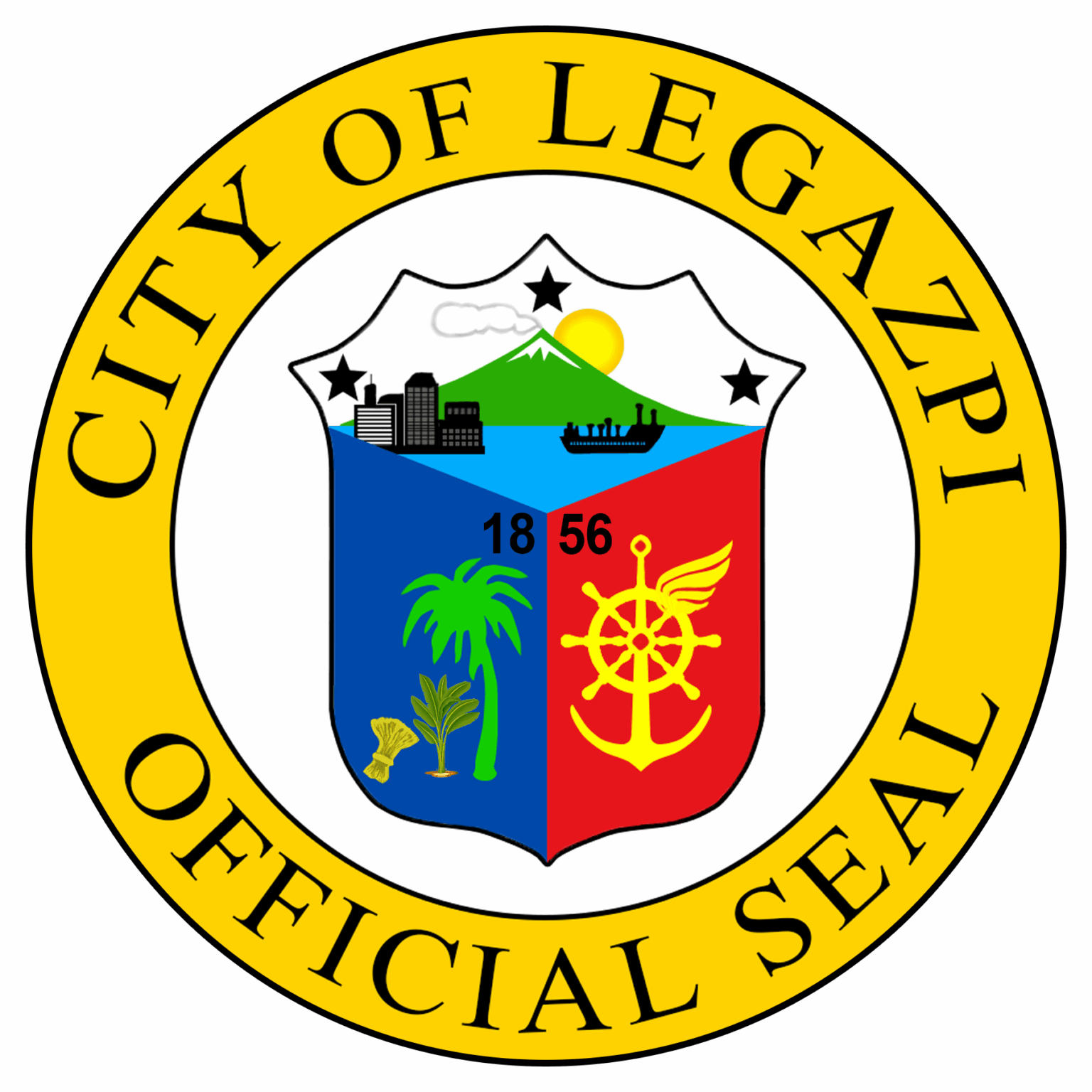
Official Seal of the City of Legazpi

Official Seal of Legazpi City

Inaugurated under Royal Decree in 1856 and codified through Republic Act No. 2234, the city seal encapsulates Legazpi's natural majesty, agricultural bounty, and maritime supremacy.

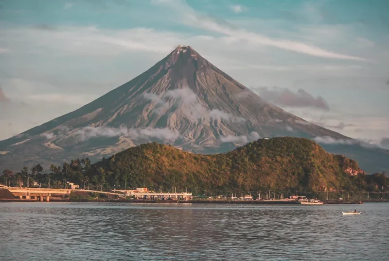
Mayon Volcano

World-renowned beauty, majesty, and enduring resilience.

Sea, Wharf & Pier

Heritage as Albay Gulf's preeminent seaport and trade gateway.

Palay, Abaca & Coconut

Primary agricultural wealth and copra export leadership.

Red, White & Blue

Patriotism and allegiance to the Philippine national flag.

Wing, Wheel & Anchor

Air connectivity, rail/highway, and maritime trade routes.

Crown Shape & Rising Sun

Civic authority paired with the rising sun of relentless progress.

Historical Turning Points

Thirteen moments that redirected the city, from a prehistoric shell scoop to today's push for cityhood. Each one opens the matching chapter of the full archive.

The Story of Legazpi, in Brief

An executive overview of the city's transformation from ancient fishing village to premier regional hub.

Legazpi began as Sawangan, a small fishing and farming settlement on Albay Gulf, first placed under Franciscan missionary care in 1587. By 1616 it had grown into the Pueblo de Albay, capital of a vast colonial district called the Partido de Ibalón. The town endured pirate raids, fires, and natural disasters over the next two centuries.

The most transformative event arrived on February 1, 1814, when Mayon Volcano erupted catastrophically, destroying Sawangan and claiming roughly 1,200 lives. Survivors scattered, some to the uplands, some to an inland settlement called Albay Nuevo, and others back to the coast, where they founded Binanuahan. In 1856, colonial authorities carved Binanuahan and neighboring barrios (Lamba, Rawis, and Bigaa) into a new town, officially named Legazpi by Royal Decree on September 22, 1856, in honor of Adelantado Don Miguel López de Legazpi. Don Lorenzo Hao became its first gobernadorcillo.

Legazpi's port expanded rapidly through the late 19th century, becoming an official port of entry in 1872 and one of the busiest overseas trading ports in the archipelago. In 1892, it achieved city status for the first time under the Becerra Law, merging with Albay and Daraga, though the Philippine Revolution ended Spanish rule six years later.

During the Philippine-American War (1900), Legazpi was the site of the fierce Battle of San Rafael Bridge. Decades later, Japanese forces occupied the town in December 1941 until Allied forces liberated it in April 1945. Post-war cityhood was re-established temporarily in 1948, dissolved in 1954, and finally established permanently on June 12, 1959 under Republic Act No. 2234, the charter in effect today.

Through the late 20th century, Legazpi was designated the administrative center of Region V (1972) while repeatedly demonstrating resilience against volcanic hazards and super typhoons. Today, fortified by major infrastructure like Legazpi Boulevard, Embarcadero, regional transport terminals, and the Bicol International Airport (2021), Legazpi stands as a top-ranked competitive and business-friendly city actively pursuing Highly Urbanized City (HUC) status.

4,000 Years of Heritage

Archaeological evidence from the Mataas Shell Scoop and Hoyop-Hoyopan Cave proves early trade across the Pacific.

Forged in Volcanic Ash

The 1814 Mayon eruption separated inland Albay Nuevo and coastal Binanuahan, creating the dual-center urban layout seen today.

Tripartite Cityhood

Legazpi earned city charters in 1892 (Becerra Law), 1948 (RA 306), and definitively on June 12, 1959 under Republic Act 2234.

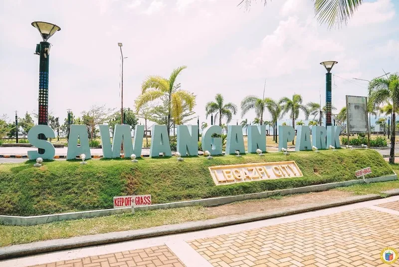
Sawangan Park, a seaside park on the Albay Gulf shore in Legazpi City.
Sawangan Park, on the stretch of Albay Gulf shore where the fishing and farming settlement of Sawangan stood. Photograph: 2024 Travel Guide

Pre-Hispanic and Early Settlement

Pre-Colonial Period

Human occupation of the wider Albay Gulf area is documented by archaeological discoveries extending back at least 4,000 years. The earliest securely dated artifact, the Mataas Shell Scoop, was radiocarbon-dated to between roughly 2000 BCE and 300 CE and was declared a National Cultural Treasure in 2010.

Jar-burial complexes uncovered at Hoyop-Hoyopan Cave in nearby Camalig, alongside corresponding coastal sites along the Albay-Sorsogon corridor, indicate continuous human habitation and participation in flourishing maritime trade networks spanning the Philippine Early Metal Age (c. 100-500 BCE) through the Song-Ming ceramic exchange era. Sixteenth-century Spanish chronicler Miguel de Loarca described the pre-contact coast as densely populated and prosperous, rich in irrigated rice cultivation, gold ornaments, and imported silk fabrics.

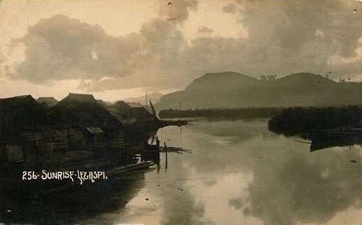
The nucleus of what is today Legazpi began as a coastal settlement known as Sawangan, a thriving cluster of fishing hamlets and farming homesteads settled along the mangrove flats and esteros bordering the western shores of Albay Gulf.
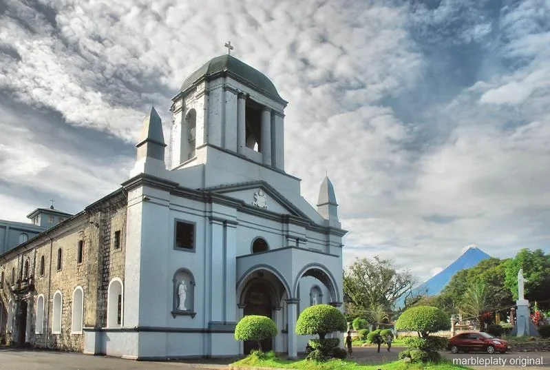
Albay Cathedral of St. Gregory the Great in the Old Albay District of Legazpi City.
Albay Cathedral, seat of the Diocese of Legazpi. The 1587 Franciscan mission at Sawangan was dedicated to the same patron, St. Gregory the Great. Photograph: 2024 Travel Guide

Spanish Contact and the Mission Era

1573-1750s

The first Europeans to navigate Albay Gulf were Captain Luis Enríquez de Guzmán and Augustinian friar Alonso Jiménez, part of an exploratory flotilla dispatched by Adelantado Miguel López de Legazpi. In July 1573, a second expedition commanded by Juan de Salcedo (Legazpi's grandson) penetrated the peninsula, establishing Spanish administrative presence at the settlement of Albaybay, later condensed to Albay.

Between 1587 and 1616, spiritual administration fell under the jurisdiction of the Franciscan friars based at the Doctrina of Cagsawa (present-day Daraga). In 1587, the Franciscans established a mission chapel in Sawangan as a visita; Fray Francisco de Santa Ana constructed the first wooden chapel dedicated to St. Gregory the Great, known as the Misión de San Gregorio Magno de Sawangan. Sawangan was elevated to a visita regular in 1605, and in 1616 became the independent Pueblo de Albay, the designated capital of the expansive Partido de Ibalón, which then covered present-day Albay, Sorsogon, Masbate, parts of Camarines Sur, and the islands of Catanduanes, Ticao, and Burias.

Throughout the 17th and 18th centuries, the settlement grew steadily through agriculture and served as a sheltered deepwater anchorage along the Manila-Acapulco galleon route. This maritime growth faced periodic disruptions: sea raids from Mindanao and Sulu, Dutch privateer incursions, a devastating typhoon in 1742, a massive church fire in 1754, and a powerful earthquake in 1811.

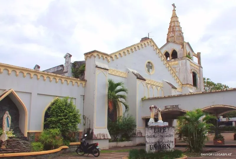
St. Raphael Church, a stone church in the Legazpi Port District with an altar of volcanic rock.
St. Raphael Church in the Port District. The survivors who returned to the coast and rebuilt Binanuahan raised a sanctuary to this patron in 1834. Photograph: 2024 Travel Guide

The 1814 Mayon Eruption and Refounding

1814-1850s

On February 1, 1814, Mayon Volcano unleashed the most cataclysmic Plinian eruption in its recorded history. Heavy tephra fall, pyroclastic surges, and volcanic debris obliterated neighboring settlements, including the parish church of Cagsawa and the towns of Budiao and Camalig. The catastrophe claimed an estimated 1,200 lives, making it the deadliest volcanic disaster recorded in Mayon's history. Sawangan itself was largely leveled to the ground.

The Great Diaspora: Led by parish priest Fray Pedro Licup, survivors initially sought sanctuary at Makalaya on Mount Bariw (Barangay Taysan). While some resettled inland at Taytay (creating Albay Nuevo), others returned to the coast and rebuilt Binanuahan ("old town").

Because an 1829 Spanish decree prohibited the proliferation of unauthorized new municipalities, the inland settlement at Taytay (Albay Nuevo) and coastal Binanuahan were administered as a single township, with Binanuahan relegated to subordinate visita status. In the 1830s and 1840s, both settlements rebuilt grand stone churches: Albay Nuevo constructed what is now St. Gregory the Great Cathedral (begun 1839), while Binanuahan built a waterfront sanctuary to a new patron, St. Raphael the Archangel (1834), anchoring the maritime port quarter.

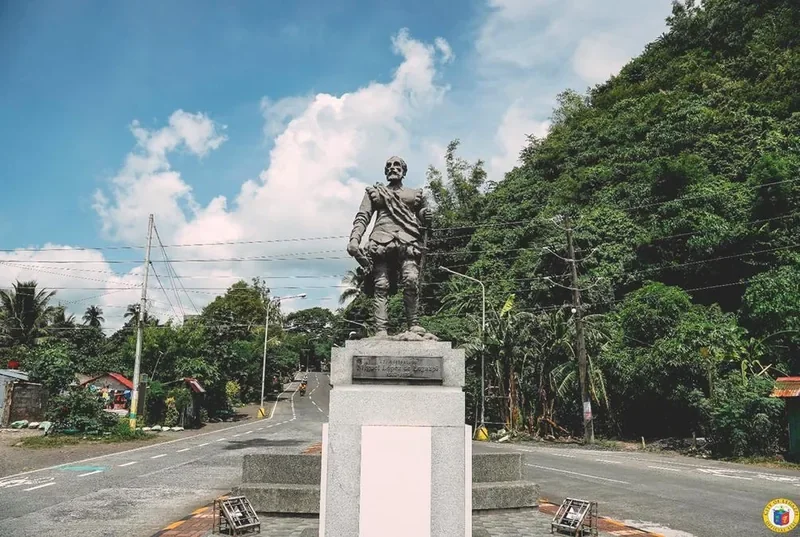
Monument to Miguel Lopez de Legazpi, the Basque-Spanish navigator, in Legazpi City.
Miguel Lopez de Legazpi. The royal decree of September 22, 1856 named the new town after him. Photograph: 2024 Travel Guide

The Naming and Founding of Legazpi

1856

On July 17, 1856, Governor-General Ramon Montero issued a decree officially separating the coastal visita of Binanuahan and the neighboring barrios of Lamba, Rawis, and Bigaa from Albay Nuevo into an independent township initially dubbed Pueblo Viejo ("Old Town").

By Royal Decree dated September 22, 1856, the ancient settlement was formally named Legazpi to honor the memory of Adelantado Don Miguel López de Legazpi. The township was formally inaugurated on October 23, 1856.

Don Lorenzo Hao was elected the first Gobernadorcillo of Legazpi, with Rev. Camilo Abainza serving as acting Parish Priest. The inland settlement retained the name "Albay" (later Albay Nuevo / Old Albay District) and continued functioning as the provincial capital.

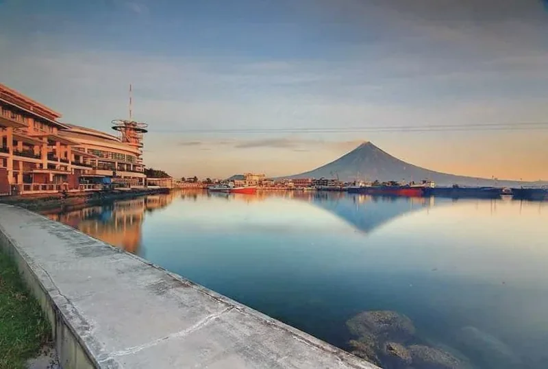
Embarcadero de Legazpi, a waterfront promenade and harbour development on Albay Gulf.
The present-day Embarcadero, on the harbour that became an official port of entry in 1872 and one of the busiest trading ports in the archipelago. Photograph: 2024 Travel Guide

Port, Trade, and First Cityhood

1872-1898

On May 18, 1872, a royal decree declared Legazpi an official port of entry for international shipping, implemented on December 3, 1874. This unlocked direct global export of Bicol's premier commodities: abaca (Manila hemp) and copra. By the late 19th century, Legazpi was widely recognized as one of the busiest and most prosperous maritime hubs in the Philippine archipelago.

Legazpi attained cityhood for the first time in 1892 under the Becerra Law. The statute consolidated Legazpi Port, Albay (Bagumbayan), and Daraga into a unified municipal administration: the Ayuntamiento of Legazpi (Albay), officially inaugurated in 1894.

In late 1898, as the Philippine Revolution swept through the archipelago, Spanish colonial authority dissolved across Albay. A revolutionary junta headed by Don Anacieto Legazpi City assumed local control, followed by General Vicente Lukbán, establishing the sovereign authority of the First Philippine Republic in Legazpi and concluding more than three centuries of Spanish rule.

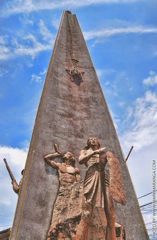
The Battle of Legazpi Pylon, a stone memorial marker in Legazpi City.
The Battle of Legazpi Pylon, memorial to the defence of the town on January 23, 1900. Photograph: 2024 Travel Guide

The American Period

1900-1941

On January 23, 1900, U.S. expeditionary forces under Brig.-Gen. William A. Kobbe landed at Legazpi to seize the abaca port. Over 800 Bicolano revolutionary soldiers commanded by Gen. José Ignacio Paua and Col. Antero Reyes mounted a valiant defense at San Rafael Bridge. This engagement resulted in 172 Filipino martyrs and stands as the bloodiest battle of the Philippine-American War in the Bicol region, commemorated today by the granite Battle of Legazpi Pylon.

The American military administration dissolved the Spanish ayuntamiento, and in 1908 reorganized the territory into separate municipalities: Legazpi Port and Albay, ending the 1892 cityhood. Daraga regained municipal independence in 1922.

Civic, educational, and transport infrastructure developed swiftly during this era: Albay High School opened in 1906, Albay Normal School in 1921 (both institutional ancestors of Bicol University), and St. Agnes Academy was founded in 1912 by the Missionary Benedictine Sisters. The Manila Railroad's iconic Bicol Express line reached Legazpi in 1938, complementing the pre-war civilian airfield (Sanborn Field).

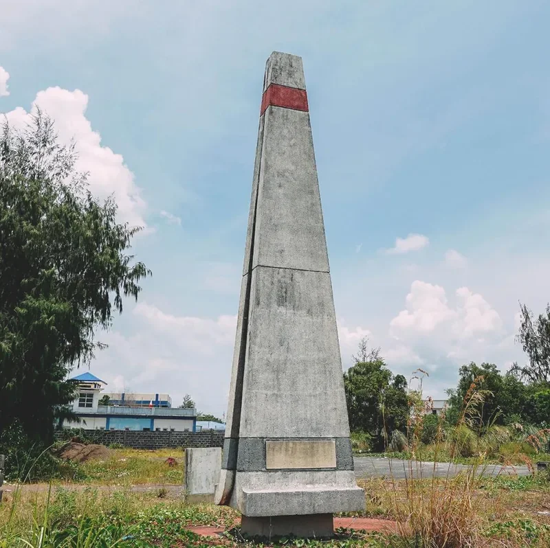
The Albay Gulf Landing Monument commemorating the 1945 Allied landing at Legazpi.
The Albay Gulf Landing Monument, raised in 1995 for the fiftieth anniversary of the Allied landing. Photograph: 2024 Travel Guide

World War II and Allied Liberation

1941-1945

At dawn on December 12, 1941, Imperial Japanese forces staged an amphibious landing at Legazpi, swiftly securing the airfield and railway terminus. While American air strikes disabled nine Japanese planes that afternoon, the enemy established a garrison. Japanese authority remained largely confined to coastal strips and the railway line, facing relentless resistance from Bicolano guerrilla forces organized under Lt. Col. Demetrio Camua.

Allied aerial bombardment and naval shelling intensified through early 1945. On April 1-2, 1945, the U.S. 158th Regimental Combat Team executed an amphibious assault on Rawis Beach. Coordinated with Camua's guerrilla units, American troops liberated the city within 48 hours. The conflict severely damaged the historic 19th-century port district, including the original St. Raphael Church and the Academia de Santa Ines, which were subsequently reconstructed post-war.

Post-War Cityhood, Dissolution, and Permanent Restoration

1945-1959

Commercial air transport resumed in 1946 with scheduled Philippine Airlines service to Manila. On July 18, 1948, Legazpi gained chartered city status for the second time under Republic Act No. 306, merging Legazpi and Daraga with Jose R. Arboleda appointed as first mayor by President Elpidio Quirino. However, on June 8, 1954, Republic Act No. 993 repealed the merger, reverting both entities to independent municipalities.

During this municipal intermission, Typhoon Trix (October 1952) battered Legazpi with winds exceeding 220 km/h, inflicting widespread devastation.

On June 12, 1959, President Carlos P. Garcia signed Republic Act No. 2234, re-establishing Legazpi as a chartered city for the third time. Amended by Republic Act No. 5525, RA 2234 stands as the permanent constitutional bedrock of the City of Legazpi. Mayor Ramon A. Arnaldo became the first city mayor under this enduring charter.

Mayon Volcano rising above the landscape near Legazpi City.
Mayon. The eruptions of 1968, 1984 and 1993 are what led the province to found APSEMO in 1995. Photograph: 2024 Travel Guide

Regional Capital and Natural Disasters

1960s-1990s

Higher education and regional influence grew rapidly through the late 1960s: Aquinas University of Legazpi was chartered in 1968 under the Dominican Order, and Bicol University was established by Republic Act No. 5521 in 1969.

In September 1972, under Presidential Decree No. 1, the Bicol provinces were organized into Region V, and Legazpi City was officially designated its regional administrative center and capital. Construction of the Regional Government Center in Barangay Rawis commenced in 1977.

Throughout this period, Legazpi demonstrated extraordinary resilience amid repeated natural calamities: the violent Mayon eruptions of 1968 and 1984, Super Typhoon Sening (1970) with sustained winds near 275 km/h, and the deadly February 2, 1993 Mayon eruption. In response to the 1993 disaster, the province founded APSEMO (Albay Public Safety and Emergency Management Office) in 1995, celebrated as the Philippines' first institutionalized local disaster risk reduction and climate adaptation model.

Cultural milestones also flourished: Pope John Paul II celebrated Mass in downtown Legazpi on February 21, 1981 during his historic papal visit, and Mayor Imelda Crisol Roces inaugurated the celebrated annual Ibalong Festival in October 1992.

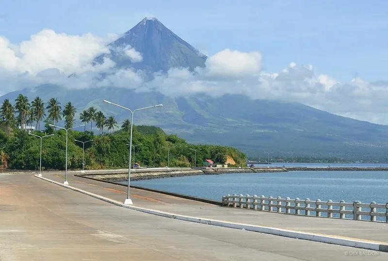
Legazpi Boulevard, a coastal promenade along Albay Gulf with Kapuntukan Hill beyond.
Legazpi Boulevard, built after the 2006 lahars as both a seaside corridor and a storm surge seawall. Photograph: 2024 Travel Guide

Modern Legazpi

2000s-Present

The 21st century inaugurated rapid economic and urban transformation. Following Typhoons Milenyo and Reming (2006), which triggered fatal volcanic lahars burying Barangay Padang, the city constructed Legazpi Boulevard, serving dual functions as an iconic seaside scenic corridor and a heavy-duty storm surge seawall.

Major commercial developments followed: the Embarcadero de Legazpi waterfront IT ecozone (2009), the Galing Pook Award-winning Legazpi Grand Central Terminal (2009), Ayala Malls Legazpi (2016), SM City Legazpi (2018, the largest shopping mall in Bicol), and Legazpi City Hospital (2018).

In 2018, Legazpi earned national acclaim by topping the National Competitiveness Council's index as the #1 Most Competitive Component City in the Philippines and received the PCCI Most Business-Friendly City award. On October 7, 2021, the state-of-the-art Bicol International Airport in Daraga commenced operations, expanding domestic and international connectivity.

In 2025, Hisham Ismail was elected Mayor, becoming the youngest chief executive in Legazpi's history. Today, having fulfilled all statutory population and revenue benchmarks, the city actively pursues official reclassification as a Highly Urbanized City (HUC).

A Note on Historiographical Discrepancies

Comparative analysis between the City Government archives and Wikipedia records
  • Daraga's Municipal Status (PD 125): The City Government's historical account cites Presidential Decree No. 125 (1973) as declaring the Municipality of Daraga part of Legazpi City. However, in contemporary administrative law and practice, Daraga functions and is legally recognized as a distinct, self-governing neighboring municipality bordering Legazpi.
  • Foundation Day Dates: The City Government's seal literature commemorates September 25, 1856 as Foundation Day, whereas historical decrees record the royal naming edict on September 22, 1856 and the formal township inauguration on October 23, 1856.
  • Founding Barangays: Official city materials credit Rawis, Bigaa, and Lamba as founding barangays, while comprehensive archival records center coastal Binanuahan (the resettled Sawangan community) as the core township to which the other three barrios were joined.
  • Demographic & Land Area Variations: Population figures range from 209,533 (city infographic) to 210,616 (2024 census), with territorial land estimates spanning 15,600 to 20,400 hectares depending on survey benchmarks.

Documentary Sources & References

Disclaimer: This historical compendium was compiled from publicly accessible records, including the Legazpi City Government's official portal and Wikipedia archives, for general informational and reference purposes only. It is not an official legal publication of the City Government of Legazpi. For authoritative municipal records, please consult the City Government of Legazpi directly.